Upper Dolpa Trek

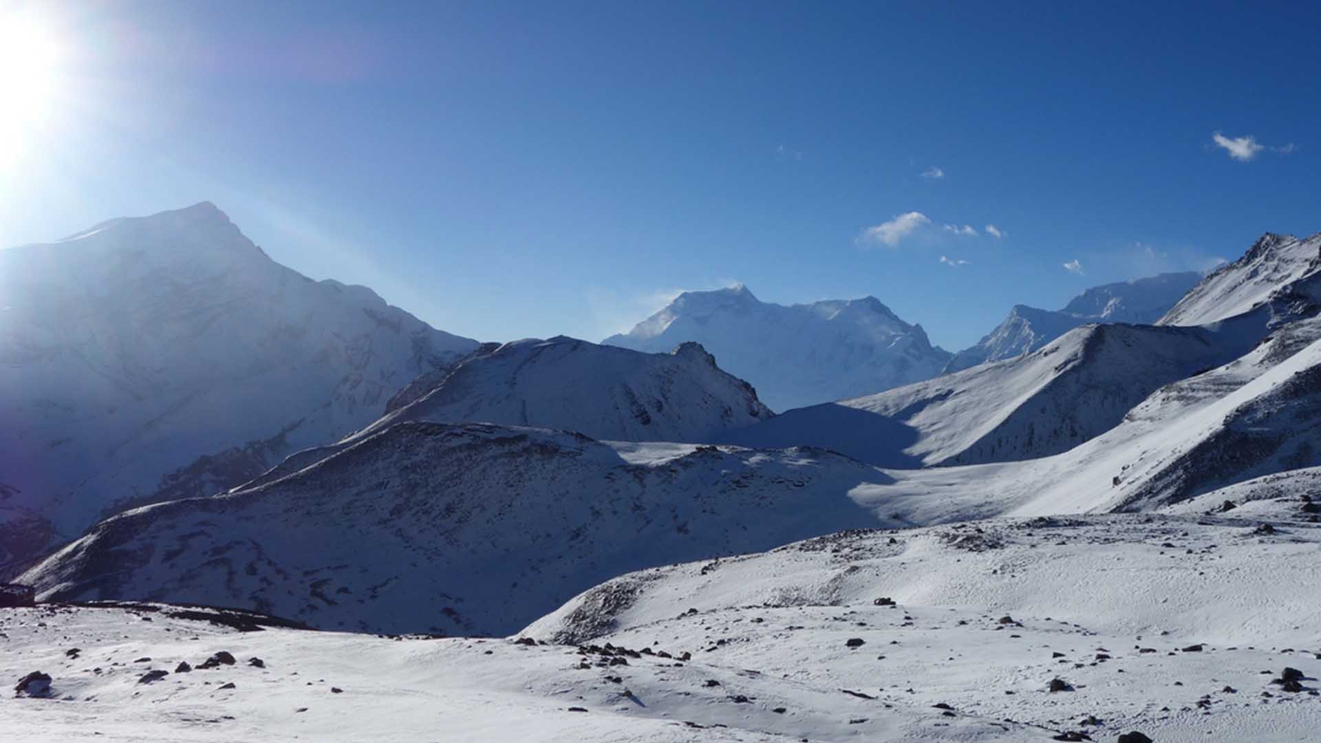
After enjoying our leisure time spent in Kathmandu , we fly to Nepalganj during daylight and in the evening we explore the beautiful city of Nepalganj . Early the next day we depart from our hotel and we fly to Juphal. The 45 minutes flight gives us the panoramic view of the giant Annapurna , the magnificent Dhaulagiri and the beautiful Kanjiroba peak. As we land at the airstrip at Juphal. We are greeted by our trek crew and from this point we commence our trek. While wandering through the terraced fields to the Bheri River we are led to Dunai, a large village and the administrative headquarter of the Dolpo region.

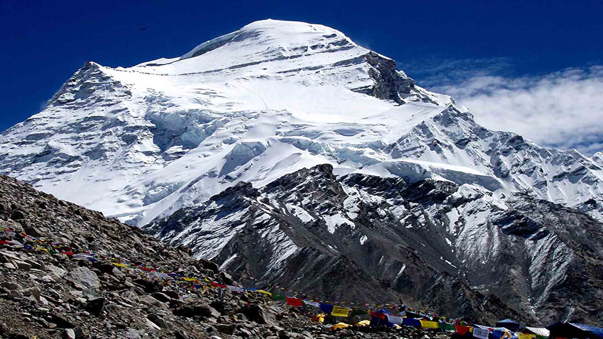
We follow the trails of the Suli Gad River listening to its roar and reach Hanke, the gateway to Phoksundo National Park . Leaving Hanke and crossing the trails of the Rinje we continue to follow the river track to reach the National Park office at Sumdo. On the way from Sumdo we ascend to a ridge from where we experience the most staggering view of the waterfall and we have our first glimpses to the Phoksundo Lake , looking beautiful in turquoise blue.

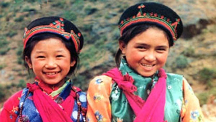
Camping on our way up & enjoying the wilderness of the region is what the trek to this area is made for. At Rigmo, a small village at the lakeside we can see the lifestyle of the people and their culture. Following the trail along the lake provides many picturesque scenes and the pleasure of viewing the lake so close. Moving our way through the trails of the Phoksundo Khola and passing through the Bhanjyang, we come to Shey Gompa (monastery known as Crystal Mountain ). Shey Gompa belongs to the Padmashambhava and Kagyu sects. The monastery was built in the 11 th century. We continue onward making our way where finally we reach the welcome sight of the pastures where grazing yak, sheep and nomadic tents made of yak fur. There we find the monastery called Namgung, which is of Karma-pa sect.

After leaving Namgung & climbing the scratchy slope and the dusty barren mountains we experience the picturesque village of Saldang , the largest village of the inner Dolpa area. Saldang belongs to the arid zone of the Trans Himalayan Tibetan plateau. The village is prosperous not only from agriculture but also for its strategic location on the trade route to Tibet . As we farewell Saldang and move onwards, we pass through terraced fields, stupas, chorten, heaps of Mani stones and the Chiba monastery. We also pass through the next village of Namdo and approach a small settlement of Sibu. Then we follow a pleasant meadow strewn with rocks, yak and other animals and cross the Jeng La.

We approach a rough track and descend to the Tarap Chu. Tarap is a dream valley with vast plains in high mountains extending 20 km along the river Tarap Chu with patches of grass on both sides of the river, completely unique and in contrast to other parts of inner Dolpa. Here we will see the blue sheep, marmots, yaks, sheep and goats and meet the shepherds taking their flock of sheep and goats to lower pastures.

We continue our walk down the Tarap Chu and then reach to the Khani Gaon. Here the quality of the foot trails varies from the broad, smooth and firm to very narrow and rocky.Leading us to the Tarakot, an old fortress known by the local people as Dzhong. Then we take our final pass to Dunai where we’ll have concluded the circuit and a celebration is sure to be had. Next we’ll move forward to Juphal from where we’ll fly back to Nepalganj and then from Nepalganj to Kathmandu.


Mt. Shisha Pangma Expedition(8,012m.)

Shisha Pangma, rising 8,012m above sea level at 85.7 degree E and 28.3 degree N, is located in central Himalaya and lies totally inside the Tibet. It is the 14th highest peak in the world. A straight forward climb and not technically demanding, an excellent mountain for climbers wanting to scale their first 8,000m. Peak without taking much risk.

Mt Shishapangma (8012) “the range above the grassy plain” was first climbed by the Chinese in 1964.There are three distinct climbing routes on the Southwest face with several other logical possibilities on the West Ridge and East face.

Mt. Cho Oyu Expedition (8,201m.)

The great bastion of Cho Oyu(8,201m.) stands astride the Nepal/Tibet border, just 70 kilometres west of Everest. It is the world’s sixth highest mountain and of the fourteen 8,000 metre peaks, it is regarded as one of the most straightforward to climb. The normal route ascends the north-west face from the Tibetan side of the Nangpa La, the old trading route to Nepal . This will be our route of ascent.
According to Lamas (Buddist Monk), ‘Cho’ is the sacred test whereas ‘Oyu’ is the Sherpa word for turquoise. A turquoise is a blue or greenish-blue precious stone. Thus the ‘Cho-Oyu’ is known as goddess of turquoise. Its towering peak stands with Everest well above the surrounding mountains.

Annapurna Circuit Trek

Following sightseeing in Kathmandu, we travel to Besisahar by private coach to tackle this classic trek in an anti-clockwise direction.

The trail from Besisahar follows the Marsyangdi River through rice paddies, terraced fields and small Hindu villages. The valley narrows as we ascend, passing waterfalls cascading from high above and soaring rock faces. The scenery becomes gradually more alpine-like and dry – resembling that of Tibet – as we bear west, curving around the back of the Annapurna range towards Manang. The remote Manang region has a distinctly medieval feel to it.

We rest at Manang to ensure we are fully acclimatized to undertake the crossing of the Thorong La: at 5416 metres, this is the highest point of the trek. The pass is the border between the Manang and Mustang regions.

We descend to Muktinath, a place of special religious significance to both Hindus and Buddhists, and home to a famous temple surrounded by 108 waterspouts which pilgrims come to bathe under.

At Jomsom, in the lower part of Mustang, we drop right to the floor of the dramatic Kali Ghandaki valley carving its way between Annapurna I and Dhaulagiri. These 8000 metre giants are only 38 kilometre apart, with the river flowing between them at a height of less than 2200 metres. This makes the Kali Ghandaki the deepest gorge in the world.

Continuing, at Tatopani we find hot springs and sub-tropical conditions – a great place to soak, soothe and refresh tired muscles! The final section of the trek is a climb again, to Ghorepani. An early start sees us climbing Poon Hill, aiming for arrival at sunrise to view a superb vista of the Annapurna, Dhaulagiri and Nilgiri Himal.

From there, we head to Naya Pul where a vehicle will transport us to Pokhara. We complete this trek with one night to relax beside the serene lake, before flying back to Kathmandu.

NOTE: It is possible to shorten this itinerary by ending the trek at Jomsom and taking a flight back to Pokhara. Please enquiry if interested in this variation.

Annapurna Base Camp Trek

Following sightseeing in Kathmandu, we fly to Pokhara, and then a short bus trip takes us to the start of our journey at Naya Pul. We commence trekking along the Modi Khola River, ascending through terraced hillsides and glimpsing the village and farming life of the primarily Hindu inhabitants of the area. We visit Ghandruk and Chomrong, the last permanent settlement in the valley.

In the Annapurna foothills, our path is a mixture of steep ups and downs, since there are several rivers to cross as we make our way along the valley towards Deurali and the Annapurna Sanctuary. We travel through forested terrain, hugging the base of Hiunchuli on our left, with magnificent Machapuchre presenting its elegant fishtail shape ahead of us on our right. In April and May, the rhododendrons will be in full bloom – gorgeous splashes of red and pink against the blue and white backdrop.

After Deurali, our ascent becomes steadier as we traverse a path on the eastern bank of the river, the old path on the west having been rendered unusable by an avalanche in 1995. Machapuchre Base Camp at 3700 metres provides us with a beautiful spot to launch an early morning walk to Annapurna Base Camp at 4130 metre. Here you truly feel embraced by the quiet majesty and awesome scale of the mountains. The soaring peaks of Annapurna South (7237m), Huinchuli, Annapurna I (8091m), Singu Chuli, Tarke Kang, Gangapurna, Annapurna III (7555m) and Machapuchre (6993m) offer a sensational panorama of almost 360 degrees with an eerie, unforgettable atmosphere.

On our descent, we retrace our steps as far as Chomrong, then divert to the hot springs at Jhinu. A soak in the warm baths with the sound of the river tumbling by is highly recommended for refreshing and re-invigorating tired bodies! The last section of track, through Pothana and Dhampus, provide views of the Dhaulagiri Himal. We finish the trek at Phedi, taking vehicle transport back to Pokhara for a day of relaxation and exploration beside Lake Phewa, before flying back to Kathmandu.

Mt. Everest Expedition (8,848m.)

Everest, Known as Chomolungma in China , stands at the height of 8,848m. It is situated right in the middle section of the Himalayas and is located at 86.9 E and 27.9 N. The north side of Chomolungma is lying within the Tingri county and the south side is lying in Nepal .

Mt. Pethangtse Expedition (6738m.)

On the border of Nepal and Tibet, half way between the summits of Mount Everest and Makalu, a climb to the Pethangtse summit is a uniquely powerful Himalayan mountaineering experience. The proximity to the world’s highest mountains is unequalled anywhere, with three of the five highest and Tibet as your immediate neighbours.  The Kangshung Face of Everest, the north faces of Lhotse, Lhotse Shar, Peak 38 and Shartse are beside you.

An expedition to Pethangtse takes you into a remote and seldom visited region of the Himalaya. The distances and remoteness discourage all but the most stalwart but the climb itself is within reach of moderately experienced mountaineers. You will need safe glacier travel techniques and the ability to use ascenders/descenders on fixed ropes. Snow and ice slopes average 40-55%.

The route offers many outstanding options. The standard approach is through Makalu Basecamp. Teams could trek out this way if desired. But it is also possible to combine a Pethangtse expedition with a climb of Mera, a climb of Baruntse, or a crossing of the Three Ice Cols (East Col, West Col, Amphulapcha). All of these are within reach from the remote Upper Hongku Valley, separated from Pethangtse and the Barun Glacier by the East and West Cols.  These options add tremendous trekking variety and cultural richness to the expedition. The distances and elevation gains on approach provide excellent opportunities to become acclimatized to the altitude.

“Here is a blog www.pethangtse.wordpress.com from the High Hope Pethangtse Expedition in 2009 supported by Adventure Thamserku”

Mt. Everest Expeditions (8,848m.)

Mount Everest is the highest mountain in the world, standing 8848m/29029ft tall, standing 5 and 1/2 miles above the sea level. Named after Sir George Everest, the British surveyor-general of India . Everest is known in Tibet as Chomolungma (it means ‘Mother Goddess of the world’) and the Nepalese call it Sagarmatha (it means ‘Forehead touching the sky’ or ‘Head in the sky’) Mount Everest is located half in Nepal and half in Tibet . Tenzing Norgay Sherpa ( Nepal ) and Sir Edmund Hillary ( New Zealand ) were the first climbers of Everest. Via the South East Ridge Route on 29 th May 1953 . In 1975, first woman ever Ms. Junko Tabei ( Japan ) summitted, via the South East Ridge.

SOUTH-EAST RIDGE

After final preparations in Kathmandu , we take a flight to Lukla and begin our teahouse trek up the Khumbu Valley to Everest base camp. We will establish our base camp at 5500m at the foot of the notorious Khumbu Icefall before making our way to Camp 01 at 6200m. We’ll climb to Camp 02 at 6600m smack in the middle of the Western Cwm, up the Lhotse face to Camp 03 at 7200m. Finally, we’ll head up the South Col. to Camp 04 at 8000m before making our summit push.


Mt. Ama Dablam Expedition (6,812m.)

Ama Dablam(6,812m.) is a beautiful mountain, located almost due south of Everest and Lhotse in the Khumbu region. Ama Dablam forms a lasting impression, as it is perhaps the most stunning mountain, together with Pumori along the popular trekking route to Everest Base Camp. Ama Dablam is a small snow capped peak lying in the Everest region. This South – West ridge is the normal and most popular route in order to ascend the Mt. Ama Dablam.

This unforgettable climb in the Khumbu region of Nepal start/end with the Lukla. It involves a cultural & exciting trek up to the base camp & also involves technical rock, snow and ice climbing and stunning panoramic summit views of world’s height & famous mountains like Everest, Lhotse , and Makalu etc.

Mt. Baruntse Expedition (7,129m.)

Baruntse(7,129m.) is one of the most beautiful 7000m peaks in Nepal . It is situated between Everest & Makalu. It is also one of the few peaks of this height with a high rate of success of ascent on normal route. The approach to the mountain follows the Mera Peak trek up to Mera La and then to Baruntse base camp. This expedition rewards you with spectacular views throughout.

We’ll establish Base Camp just above the Five Holy Lakes “Panch Pokhari” at 5,400m and one or two higher camps on the mountain. We’ll ascend the 6,100m West Col before establishing Camp 1, where the long ridge leading to the summit is clearly visible. A tricky step at around 7,000m adds further spice to the climb. The route is generally a straightforward snow and ice climb and technically climbing skills and experience demanding.